Hike: Yosemite
Date: 10/24/99
With whom: Aaron
[Previous Hike] [Hiking
Index] [Next Hike]
Day 1: Arrival
Day 1: Yosemite Falls
Day 2: Glacier Point
Day 2: Sentinel Dome
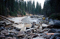
Day 2: Panorama Trail, Illilouette Falls, Nevada
Falls
Distance: 3 miles roundtrip
Elevation: 7000' to 8122'
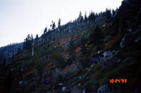
Aaron and I started up the way to Sentinel Dome. It's a short hike to get to
the base of the dome 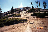
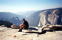
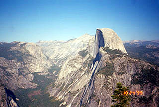
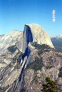
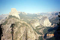
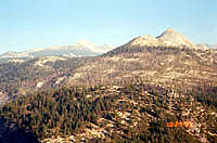
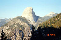
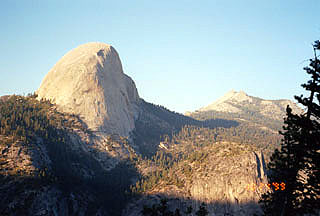
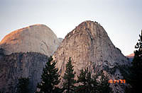
From on top of Sentinel dome, we were treated to a wonderful 360º view. This view included views
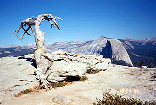
of El Capitan (below, left), Half Dome (below, center), and Mt. Starr King and the Clark Range (below, right).
As you can see, it was a little bit hazy that day.
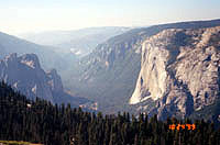
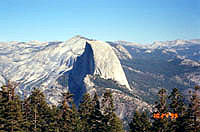
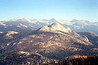
The smoke from several fires in Yosemite and the surrounding area were visible from here.
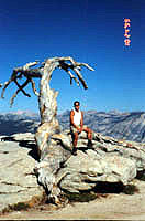
There was a cool looking, dead tree at the top
of Sentinel Dome (picture above and picture at top of page).
 On our way back down, Aaron had to go to the bathroom. He started off towards
the parking lot (where he suspected there were bathrooms) and I just ducked around
a bush. After I finished, I waited, but there was no sign of Aaron. I started
calling out his name, but there was no answer. I decided to just go lay out in
the sun for awhile. After about 25 minutes I decided to try to find him, so I
started to walk towards the parking lot. I asked a couple who was heading up from
the parking lot how far away it was. They answered about a mile. I didn't feel
like walking a mile down (there was a bit of elevation drop) to the parking lot
since we had a long hike to go and I didn't know if Aaron had already headed back
to Glacier Point directly from the parking lot. So, I decided to head down to
Glacier Point where we would start the next section of our day hike and see if
he was there/wait for him.
On our way back down, Aaron had to go to the bathroom. He started off towards
the parking lot (where he suspected there were bathrooms) and I just ducked around
a bush. After I finished, I waited, but there was no sign of Aaron. I started
calling out his name, but there was no answer. I decided to just go lay out in
the sun for awhile. After about 25 minutes I decided to try to find him, so I
started to walk towards the parking lot. I asked a couple who was heading up from
the parking lot how far away it was. They answered about a mile. I didn't feel
like walking a mile down (there was a bit of elevation drop) to the parking lot
since we had a long hike to go and I didn't know if Aaron had already headed back
to Glacier Point directly from the parking lot. So, I decided to head down to
Glacier Point where we would start the next section of our day hike and see if
he was there/wait for him.
Aaron wasn't there so I just hung out and waited. A few people asked me about my hiking that day
and other hikes in the park and it was fun to talk to them and share my experiences.
Distance: 7.4 miles one way
Elevation: 7000' to 4000'
Aaron and I didn't get started on this section of our hike until about 4:00pm-4:15pm or so. We expected
that we would take at least 2.5 hours even if we sustained a 3mph pace primarily downhill. We figured that
this would bring us back into the valley just after sunset.
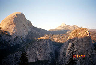
One of the exciting things about this hike was that we were able to hike a part of the park that
neither one of us had yet hiked. The views were very nice from along the Panorama trail and we
were treated to some different views of Half Dome. One of the most pleasant surprises was
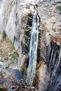
passing by Illilouette Falls (below, center). Even though it was late in the year and the water flow
was minimal, it was still a beautiful waterfall. I especially like the water spread out as it fell.
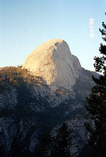
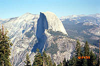
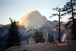
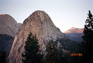
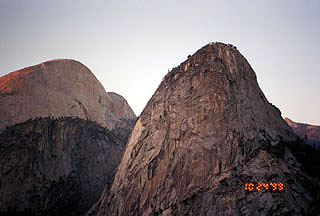
As the we hiked onward, we were treated to a southwestern views of Half Dome lit
by the setting sun. I especially enjoyed the views with Clouds Rest in the background,
having hiked there about a year previous.
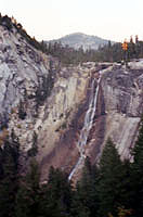
We were also able to get some very up close views of Liberty Cap as we neared the Nevada Falls.
It was getting late and the sun set while we still had 1.5 miles to go or so. We ended up hiking
by flashlights in the dark for the last 30-45 minutes or so.
Even after that, we still had to stop by Camp Curry and pick up our extra food and toiletries (we
couldn't leave them in the car because of bears and didn't want to carry them because of the extra
weight) and then get to the car. We didn't make it to the car until about 8:30pm and back to
the city until 12:30pm-1:00pm. A full day!
Day 1: Arrival
Day 1: Yosemite Falls
Day 2: Glacier Point
Day 2: Sentinel Dome
Day 2: Panorama Trail, Illilouette Falls, Nevada
Falls

[Main Index] [Hiking
Index]